- Home
- Property Map - Features
Property Map - Features
Return to Property Map page
- You will receive aerial images of both the satellite view and outline view of your property (based on the property address that you provide when registering.)
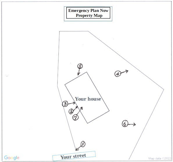
- You should print one of these and mark it up with labels which designate utility shutoff locations and locations of other important items to attend to (such as fuel storage) in the event of an emergency.
Example - Satellite image:

Example - Outline image:

Example - Customer prints Outline image and adds labels. Then place it in an accessible location, along with Property Map Key (see below), for reference during an emergency.
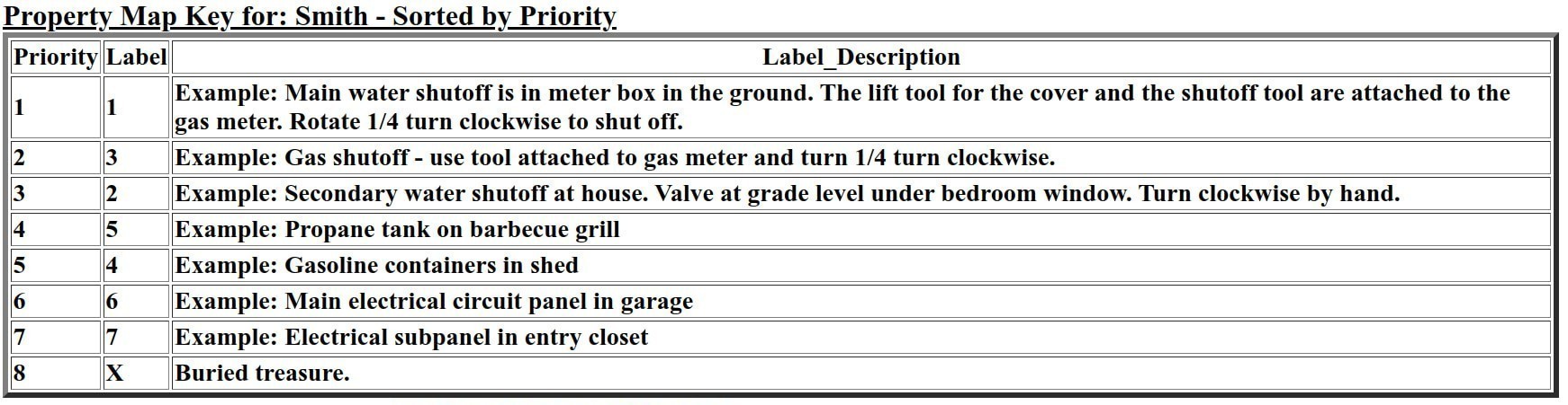
Below is an image of your Property Map Key.
- This template should be edited to reference and provide detail for your labels in your marked up Property Map.
- It should then be printed, and along with the printed Property Map (with labels), placed in an accessible location for reference during an emergency.
Return to Property Map page